The Arrival
After our flight back from the Arctic Circle we drove from Anchorage to our new AirBnB just outside of Seward. The drive was a bit over two hours and we found the AirBnb at about 9:45pm local time which is about 10:45 PDT which is 45 minutes past bedtime. And that’s how it felt. We still needed to move the cooler and a few bags in and unpack the cooler. But before we could do those things we were happy to confirm that we have running water and a bathroom that includes a shower.
We’ll be here until July 11th.
Day 1 (Mostly Domestic Stuff)
On Tuesday morning we tried to unpack and arrange the AirBnB in a way that suits us. The Erg is nearly blocking the door but that is better than tripping over it on nightime trips to the bathroom.
For a town of only 2700 Seward seems to have a lot of coffee sources… and we plan on trying all of them, or at least, all that are rated at least 4 stars. We started by going to Summit Sips. For me, this is the test: an establishment has a menu on which the smallest cup is 12 oz. and I ask for an 8 oz. breve and if they try, they pass the test. Summit Sips not only passed but provided a great 8 oz. breve with foam art.
We also needed to fill the car with gas and find a grocery store. On the first point we have a 2021 Honda CRV. Not the hybrid kind. For most of its life we’ve been getting about 31 mpg. For this entire trip I’ve been “working it.” Mostly that means not accelerating too quickly and being willing to surrender speed when going uphill using downhills to gain kinetic energy. And no braking. That’s important. For the entire Alaska trip we’re at about 3600 miles at 35.2 mpg.
The grocery store we found was a Safeway. It’s not our favorite store but at least we know what we’re going to get and often has Extra-Dark Lindor Balls. We had planned 3 dinners and we expected that those meals would end up lasting more than three day.
Then we found a laundrymat and washed our clothes. Each load was $8.00 and it had to be payed in quarters. That’s pretty funny.
We also started walking up Marathon Mountain. There is a race up the mountain every July 4th which was won a few times by Allison Ostrander who Arlene follows on Youtube. She grew up nearby and started running in the race when she was 10. There is a great video on Youtube where she’s goes through her first, maybe, 8 participations in the race and I found the video compelling. Last summer Arlene and I went to Eugene, OR to see the 7th day of the Olymipic Trials where Allie was competing in the steeple chase. It is interesting to connect the place to the person. (I hate the word “interesting,” but I’ve got nothing better.)
Day 2 (Exit Glacier)
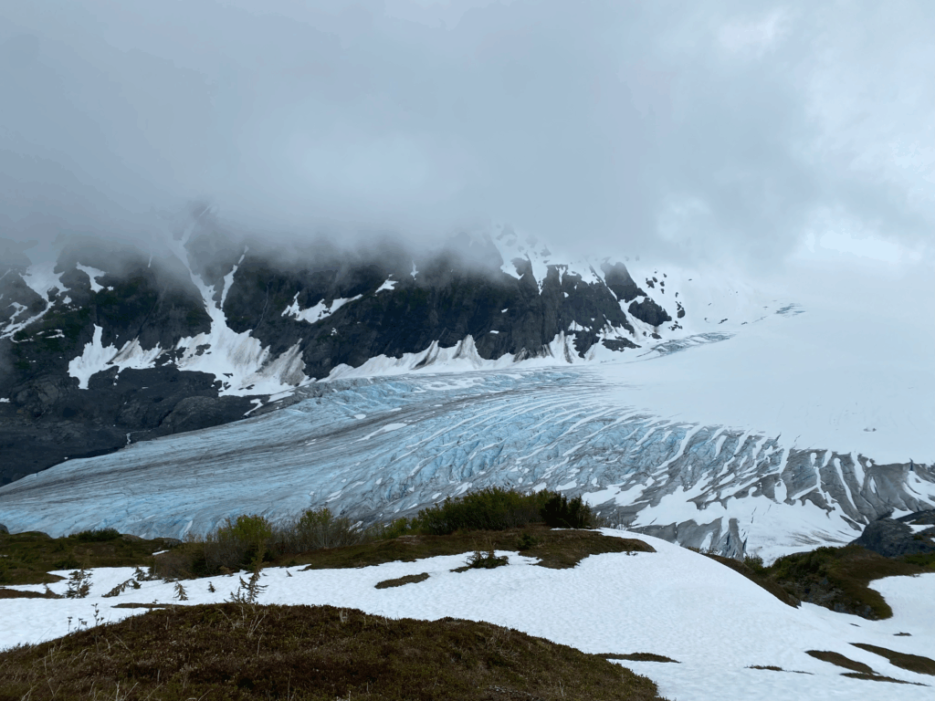
We drove out to a trailhead to with viewpoints for Exit Glacier. We were looking at taking the hardest option to the Harding Icefield, 8.6 miles with 3200 feet of climbing but we’ve should have known that something was suspicious when there were signs in the parking lot for passenger cars and tour buses.
Long story short: there were tons of people at every step on this hike and I will not mention it again, but you’ll need to insert lots of random people doing random things with everything else that I say here.
The up part of the hike was divided into sections of very steep and other sections of fairly mild–a nice combination. At one point we passed a crew of young people working on the trail with several laying stones, building steps, and ensuring solidity and several more harvesting stones for use on the trail. A large young man was holding a large piece of rock as we were passing and Arlene stopped to give him time to descend a bit and place the rock. One of the other members of the crew mentions that she was the first one to be considerate.
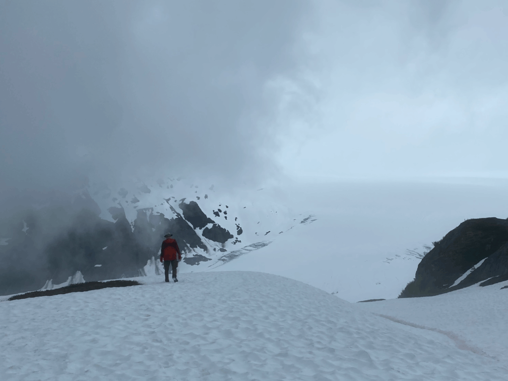
Eventually we climbed high enough to be in the snow. We were just careful and the first couple of sections of snow but when the snow became persistent we stopped and put on our crampons. We hadn’t used them since that bout of frozen rain we had on Bainbridge, maybe two-and-a-half years ago. They were great and we climbed up steep slopes of snow without too much problem. As were were climbing fog/cloud moved up the glacier and our visibility was diminished. Then we reached a point where the paths in the snow disappeared. We checked Arlene’s phone and her application AllTrails with the downloaded map. According to the gps we were not on the trail and we decided that it was time to turn around. But we had a nice view of the glacier.
And here is a picture of me that Arlene took when my back was turned:
We ate our peanut butter -n- jelly sandwiches and began the descent.