The Flight
Arlene and I had mostly packed on Friday night and on Saturday morning we finished that process and left the dry cabin near Denali at about 6:40am. The first 90 minutes of the drive were the same route that we had taken the previous Saturday to see spectacular views of moutains all the way to the horizon, but on this Saturday, it was cloudy.
We stopped for coffee in Anchorage at Black Cup Coffee which was not hard to find and crowded and tasty. Our plan had been to pick up the coffee then drive to a park for a lunch that we had prepared in the cooler. But I made a wrong turn and then became confused and rushed to the airport thinking that all of our time was slipping away and we were on the verge of being late for our 2:26pm flight. So we skipped the park, ate lunch in the parking garage, navigated to the terminal and through security and only then realized that we had a time zone problem (again) and had two-and-a-half hours to wait for our flight.
We know how to wait a long time for a flight; we’ve done it before.
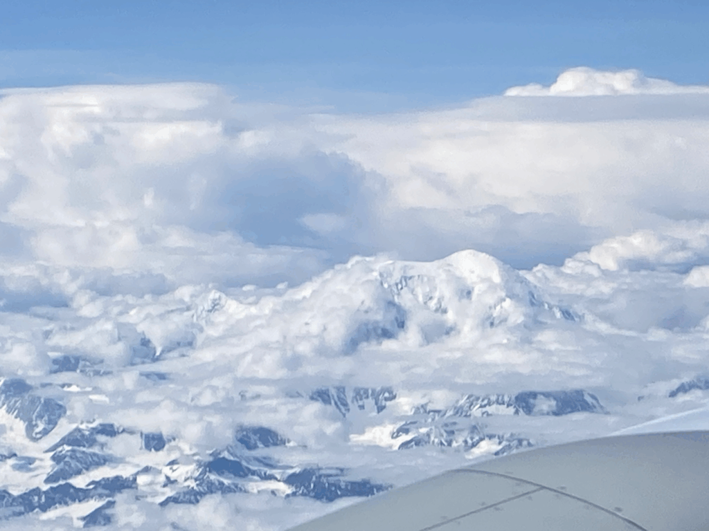
The view from the airplane was amazing. Here is Denali:
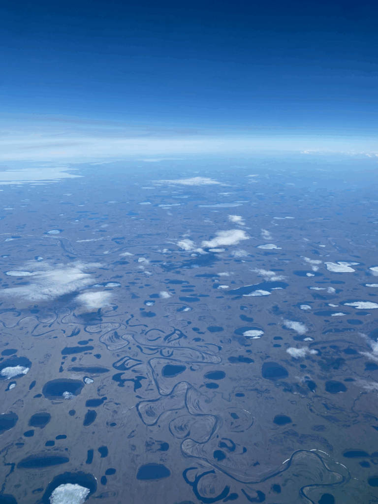
There are a couple of hundred miles of tundra surrounding Utqiaġvik. I always pictured tundra as grassy with a little snow on top with, maybe, what, grazing caribou? Here is the picture that Arlene took from the window seat:
The First Night
We landed at the airport, descended the stairs to the tarmac and crossed into the tiny terminal. We hadn’t planned on how to get from the airport to the hotel but someone noticed our confused looks and asked “Top of the World Hotel? There is a shuttle outside.” So we exited the terminal on the street-side 30 seconds after we had entered on the runway side, walked about 30 feet and climbed into a van with the words “Top of the World Hotel” and “tundratours.com” on the side. In the van were a talkative woman from Ohio, a couple from India currently working in Fairbanks and a woman from Anchorage who was less talkative.
We checked into the hotel and started following our normal “in a new city” playbook which means we got online, found a grocery store and started walking.
Utqiaġvik is divided into three sections: the farthest south is Barrow which is separated from Bowerville farther north by a lagoon. Then NARL is about 2 miles farther north but reachable by a road that goes along the Arctic Ocean with occational buildings, tundra and more lagoons. Our hotel was as the southern part of Bowerville so we walked south into Barrow to find the largest grocery store in the area. We bought four cups of yogurt, a bag of granola and a bag of potato chips for $40. Lol.
We also went to look at the Arctic Ocean up close. It was unlike other oceans that we’ve seen such as the Pacific and the Atlantic. There were no waves since only a short distance from shore the thing appeared to be covered in ice. Closer to shore much was thawed but patches of ice still floated by slowly. It almost looked stagnant. And tides were nearly non-existent; the difference between low and high tides was 4 inches?
We returned to the room in the hotel. (Walking from the ocean to the hotel took maybe a minute.) At bedtime we set an alarm for 2:30am which was supposed to be “solar midnight” in Utqiaġvik.
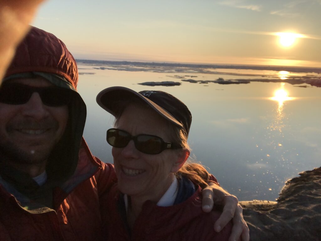
When the alarm woke us we trudged back out the to ocean. In the disance you can see the ice. And the sun still above the horizon. It was cold–maybe in the mid-30s Fahrenheit.
Achieving One Of Our Main Goals
About 9.5 miles mostly north of the hotel is Point Barrow, the most extreme northerly point in the United States. There were tours available to take us out there but we called multiple times and only reached voicemail and filled out on online form, also with no response. Finally we asked a cabby if he could take us out there. (There were lots of cabs.) He said that chartering a cab for 1 hour was $100. We asked him to meet us back at the hotel at noon and he agreed.
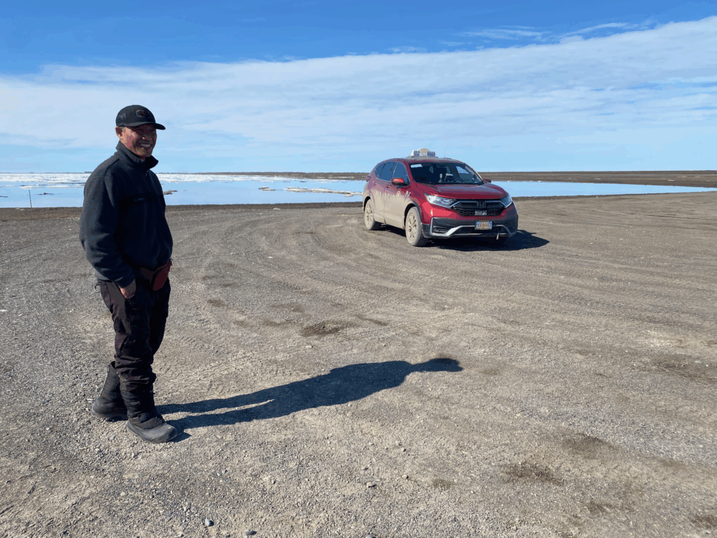
Once he picked us up, he seemed intent on giving us a much broader tour. He showed us the field on which the high school football team played football. He showed a funny little bridge called “The Bridge at the Top of the World.” (We took a picture of the bridge which must have been about 20 feet long from a road a short distance away that paralleled it.) He showed two buildings that remained from an Army presence in World War II. He also showed us Long-Tailed Ducks and Brants (a type of goose); he really liked the birds and while we took pictures, he also took pictures. Finally we arrived at the end of the road to Point Barrow; we may be been a little short of the actual point, but there was no more road and we were in a Honda. Here is a picture of our cab driver. He is from Thailand.
Monday Morning
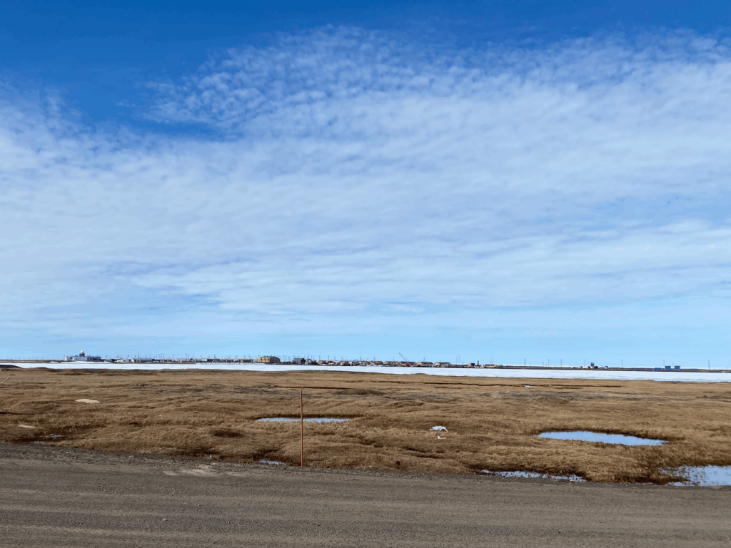
On Monday we just wondered first through, then out of town. Here is a picture of Utqiaġvik from accross the tundra. There isn’t much there with a population of only about 4700.
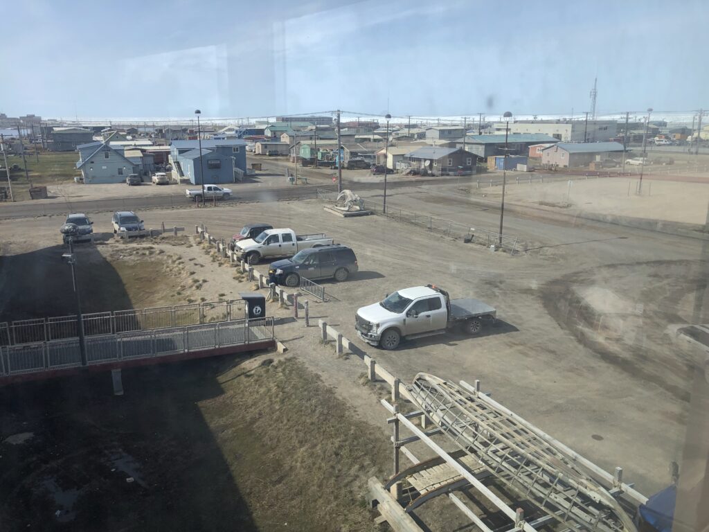
Here is another picture of the town from the 3rd floor of the Iñupiat Heritage Center. In the distance, again, is the Arctic Ocean.
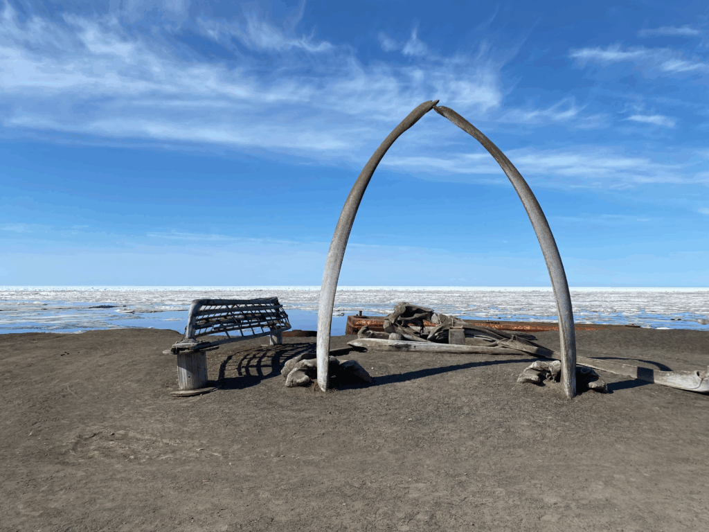
And the famous whalebone arch.
Here is the restaurant in the hotel where we ate dinner on both Saturday and Sunday.
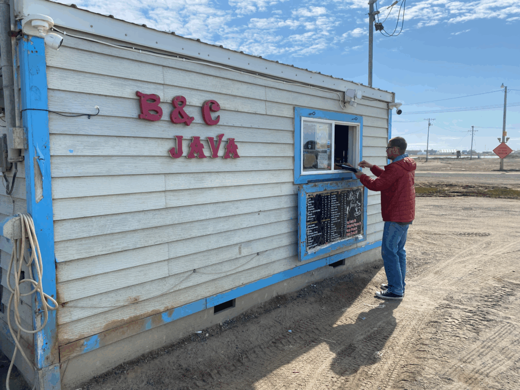
And this is the shack where we were able to get espresso. It didn’t open until 11am! And they were late opening both mornings we were there!
Gotta Say
What a trippy experience.